Linking website, web services, … using URL
This section applies mainly to ISO19139 records and partially to Dublin Core (ie. only documents can be associated in Dublin Core) standards.
Linking a document
2 approaches can be used to link documents:
- by providing a URL
- by uploading a document
To add a new one, click on the + caret button then Add an online resource
button or, if alreay one exists, just click on the title of the Online resources.
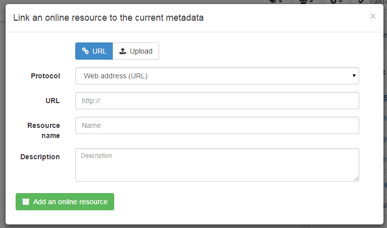
To link a URL, set the following properties:
Protocolto describe the type of document attached (Web address (URL)is the default)Linkageto point to the target document. It can be any type of links like http://, ftp://, file:///, …Nameis optional and provides a label for making an hyperlinkDescriptionis optional and provides more details about the link
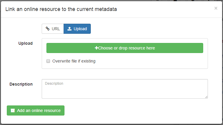
To upload a document, switch to the Upload tab and choose a document,
or drag and drop it in the pop up. In that case, the protocol is hidden
and is set to WWW:DOWNLOAD.
Depending on your needs, more specific links could be added and will be associated to different actions and display in the applications.
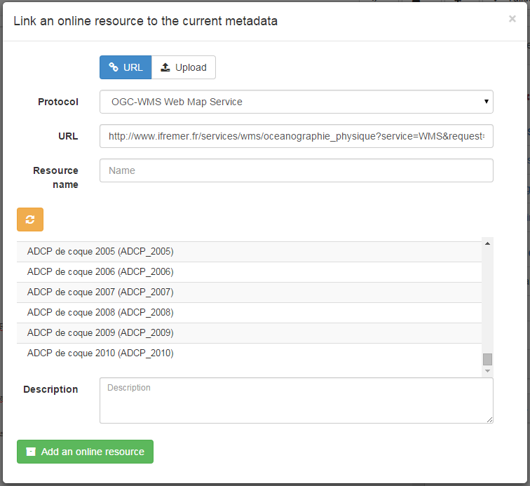
Linking a WMS layer
To be able to view a record on the map viewer, it may be relevant to add a reference to one or more WMS services publishing the dataset. An online resource is encoded using the following in ISO19139:
<gmd:onLine xmlns:gmd="http://www.isotc211.org/2005/gmd"
            xmlns:gco="http://www.isotc211.org/2005/gco">
   <gmd:CI_OnlineResource>
      <gmd:linkage>
         <gmd:URL>https://download.data.grandlyon.com/wms/grandlyon</gmd:URL>
      </gmd:linkage>
      <gmd:protocol>
         <gco:CharacterString>OGC:WMS</gco:CharacterString>
      </gmd:protocol>
      <gmd:name>
         <gco:CharacterString>cad_cadastre.cadsubdivisionsection</gco:CharacterString>
      </gmd:name>
      <gmd:description>
         <gco:CharacterString>Subdivision de section cadastrale (Plan cadastral informatisé du Grand Lyon)(OGC:WMS)</gco:CharacterString>
      </gmd:description>
   </gmd:CI_OnlineResource>
</gmd:onLine>
To add a WMS layer:
- choose the protocol
OGC:WMS Web Map Service, - set the URL of the service,
- then the wizzard query the service to retrieve the list of layers
- choose one or more layer in the list or set it manually.
Linking a database table or a GIS file on the network
To reference a GIS file or a database table, user can upload or link to a that resource (see Linking a document). The type of protocol depends on the type of resource associated:
| Type of resource | Vector file uploaded (eg. zipped Shapefile) |
|---|---|
| URL | File URL created after upload on the catalog. eg. http://localhost:8080/geonetwork/srv/eng/resources.get?id=1631&fname=CCM.zip&access=private |
| Protocol | WWW:DOWNLOAD |
| Name | File name (readonly) |
| Type of resource | Vector file on the network |
|---|---|
| URL | File path. eg. file:///shared/geodata/world/hydrology/rivers.shp |
| Protocol | FILE:GEO or FILE:RASTER |
| Name | File description |
| Type of resource | Vector (Table PostGIS) |
|---|---|
| URL | jdbc:postgresql://localhost:5432/login:password@db |
| Protocol | DB:POSTGIS |
| Name | Table name |
When having information about the database or file on the local network, it may be relevant to hide those informations for public users (see Restricting information to metadata sections).
Todo
Add doc & link to geopublisher