GeoNetwork opensource
  • Overview
    • About
    • License
    • Author
      • Project Steering Committee (PSC)
      • Committers
      • Contributors
      • The documentation
    • Change log
      • Version 3.0.0
      • Version 3.0.1
      • Version 3.0.2
      • Version 3.0.3
      • Version 3.0.4
      • Version 3.2.0
      • Version 3.2.1
      • Version 3.2.2
      • Version 3.4.0
      • Version 3.4.2
      • Version 3.4.3
      • Version 3.4.4
      • Version 3.6.0
      • Version 3.8.0
      • Version 3.8.1
      • Version 3.8.2
  • User guide
    • Quick start
      • Starting the catalog
      • Signing in and load templates
      • Searching information
      • Discovering information
      • For more information
    • Describing information
      • Creating templates
      • Creating a new record
      • Importing a new record
      • Editing metadata
      • Deleting a record
      • Multilingual editing
      • Describing resources for the INSPIRE directive
    • Associating resources
      • Associating documents
      • Associating another record
      • Digital Object Identifier (DOI)
    • Classify information
      • Tagging with categories
      • Tagging with keywords
    • Publishing
      • Managing privileges
      • Restricting information to metadata sections
      • Transferring privileges
    • Analyzing data
      • Statistics on catalog content
      • Analyze and visualize data
    • Workflow
      • Validation
      • Suggestion for improving metadata content
      • Life cycle
      • Publishing GIS data in a map server
      • Versioning
      • Updating a set of records
    • Harvesting
      • GeoNetwork 2.0 Harvester
      • Harvesting CSW services
      • Harvesting OGC Services
      • Local File System Harvesting
      • WEBDAV Harvesting
      • OAIPMH Harvesting
      • Harvesting an ARCSDE Node
      • GeoPortal REST Harvesting
      • THREDDS Harvesting
      • WFS GetFeature Harvesting
      • Z3950 Harvesting
      • Mechanism overview
      • Harvesting life cycle
      • Multiple harvesting and hierarchies
      • Harvesting Fragments of Metadata to support re-use
      • HTTPS support
      • The main page
      • Harvesting Status and Error Icons
      • Harvesting result tips
      • Adding new harvesters
      • Harvest History
    • Exporting records
      • Export as a ZIP archive
      • Export as a CSV file
  • Administrator guide
    • Configuring the catalog
      • System configuration
      • User Interface Configuration
      • Configuring CSW
      • Configuring virtual CSW
      • Configuring for the INSPIRE Directive
      • Map servers configuration for geopublication
    • Managing users and groups
      • Creating group
      • Creating user
      • User Self-Registration
      • Authentication mode
      • Default user
      • User session
      • Users, Groups and Roles
    • Managing classification system
      • Managing categories
      • Managing directories
      • Managing thesaurus
    • Managing metadata standards
      • Adding a schema
  • Maintainer guide
    • Installing the application
      • Installing from the installer
      • Installing from WAR file
      • Installing from source code
      • Installing remote index
      • Configuring the database
      • Loading templates and sample data
      • Customizing the data directory
      • Using multinode mode
    • Setting up search/content statistics
      • Setup ElasticSearch
      • Setup Kibana
      • Setup GeoNetwork
    • Updating the application
      • Automatic update
      • Manual update
    • Backup the application
  • API guide
    • Catalog Service for the Web (CSW)
    • OpenSearch
    • Open Archive Initiative (OAI)
    • Z39-50
    • RDF DCAT end point
      • URLS
      • Query parameters
    • GeoNetwork API
      • Building client for the API using codegen
    • Q Search
      • Query results parameters
      • Query filter parameters
      • Date Searches
      • Query examples
  • Contributing guide
    • Writing documentation
      • Build the docs
      • Edit the reStructuredText files
      • Sphinx
    • Translating the application
    • Translating a standard
    • Making a pull request
    • Doing a GeoNetwork release
  • Customizing guide
    • Search application
      • Create your own view
      • Change default view configuration
      • Create your own view
      • Enrich your custom view
      • Wro4j resource management
    • Customizing metadata views
    • Customizing editor
      • Defining field type
      • Grouping element from the standards
      • Defining multilingual fields
      • Configuring views
      • Defining a view
      • Defining a tab
      • Adding a section to a tab
      • Adding a field
      • Adding a template based field
      • Adding documentation or help
      • Adding a button
    • Theming
    • Configuring search fields
      • Add a search field
      • Boosting documents and fields
      • Boosting search results
    • Configuring facetted search
      • Facet principle
      • Facet response when searching
      • Configuration
    • Advanced configuration
      • User session timeout configuration
    • Implementing schema plugins
      • Metadata schemas and profiles
      • Implementing a metadata schema or profile
      • Schema Plugins
    • Characterset
    • Miscellaneous
      • Invalid CSRF Token
  • Tutorials
    • Introduction to GeoNetwork
      • Deployment
      • Setup
      • Editing Metadata
      • Harvesting
    • Customize your GeoNetwork UI
      • Search page
      • Formatter
    • Hook your own code
      • Separate your code
      • Using Events
      • Adding new User Interface
      • Schema Plugins
      • Search Fields
  • Annexes
    • Metadata Exchange Format (MEF)
    • Glossary
    • Standards
      • ISO Standard for metadata on Geographic Information (ISO 19139)
      • Dublin Core
 
GeoNetwork opensource
  • Docs »
  • Administrator guide
  • Edit on GitHub

Administrator guideΒΆ

  • Configuring the catalog
    • System configuration
    • User Interface Configuration
    • Configuring CSW
    • Configuring virtual CSW
    • Configuring for the INSPIRE Directive
    • Map servers configuration for geopublication
  • Managing users and groups
    • Creating group
    • Creating user
    • User Self-Registration
    • Authentication mode
    • Default user
    • User session
    • Users, Groups and Roles
  • Managing classification system
    • Managing categories
    • Managing directories
    • Managing thesaurus
  • Managing metadata standards
    • Adding a schema
../_images/admin.png

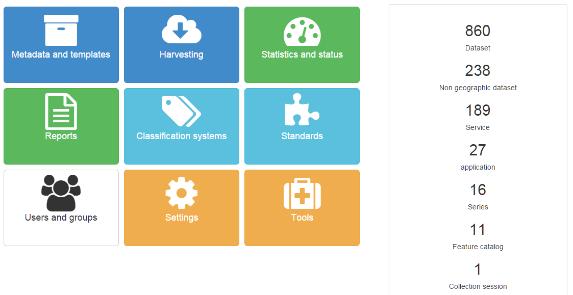
All Admin functions are available from the Admin Dashboard from the main menu. On the Admin Dashboard you will find shortcuts to any administration option your role can access.

Next Previous

© Copyright 2001-2019, GeoNetwork opensource. Licensed under Creative Commons Attribution ShareAlike (Unported) v3.0 License.

Built with Sphinx using a theme provided by Read the Docs.