 IDECyL
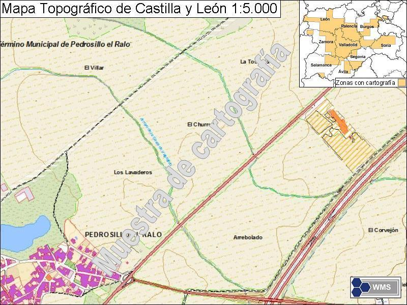
Mapa Topográfico CyL 1:5.000: Servicio WMS
Servicio web de mapas de tipo WMS:OGC que implementa la Serie Mapa Topográfico de Castilla y León 1:5.000 para su visualización y consulta.
Aglutina toda las hojas de cartografía topográfica básica de ámbito territorial elaboradas para la formación de la Serie Mapa Topográfico de Castilla y León 1:5.000.
Consta de los siguientes niveles temáticos de información:
- Sistemas de coordenadas
- Cuadrícula geográfica
- Unidades administrativas
- Redes de transporte
- Hidrografía
- Elevaciones
- Cubierta terrestre
- Edificaciones y construcciones
- Servicios e instalaciones
Simple
Información de identificación
- Fecha ( Fecha de publicación )
- 2009-10-01
- Fecha ( Fecha de revisión )
- 2010-11-01
- Propósito
- Disponer de cartografía topográfica detallada del territorio de la Comunidad de Castilla y León
- Créditos
- Junta de Castilla y León
- GEMET - INSPIRE themes, version 1.0 ( Tema )
- European Territorial Units ( Ubicación )
-
- ESPAÑA
- Castilla y León
- ISO - 19119 geographic services taxonomy ( Tema )
-
- Servicio de acceso a mapas
- infoMapAccessService
- Servicio de gestión de modelos/información geográficos
- infoManagementService
- WebServicesSpecification
-
- 1.3.0
- WMS
- OGC
- Limitaciones de uso
- https://datosabiertos.jcyl.es/web/jcyl/RISP/es/Plantilla100/1284235967637/_/_/_
- Limitaciones de acceso
- otherRestrictions Otras restricciones
- Restricciones de acceso y uso
- license Licencia
- Otras restricciones
- Sin validez jurídica, carácter informativo. Uso libre y gratuito. Cita obligada a la propiedad de la fuente: "Junta de Castilla y León". Condiciones detalladas en:
- Tipo de servicio
- view
))
- Tipo de acoplamiento
- tight Ajustado (tight)
Operaciones contenidas
- Nombre de operación
- GetCapabilities
- Plataformas de computación distribuida
- WebServices Servicios web
Operaciones contenidas
- Nombre de operación
- GetMap
- Plataformas de computación distribuida
- WebServices Servicios web
- Punto de conexión
- https://idecyl.jcyl.es/geoserver/mapacyl/MapaCyL5/wms?
Operaciones contenidas
- Nombre de operación
- GetFeatureInfo
- Plataformas de computación distribuida
- WebServices Servicios web
- Punto de conexión
- https://idecyl.jcyl.es/geoserver/mapacyl/MapaCyL5/wms?
- Opera en
- Formato de distribución
-
- Recurso en línea
-
https://idecyl.jcyl.es/geoserver/mapacyl/MapaCyL5/wms?
(
WWW:LINK-1.0-http--link
)
VISUALIZAR MAPA
- Nivel jerárquico
- service Servicio
- Otro
- Servicio web de datos espaciales. Servicio de visualización
Resultado de conformidad
- Fecha ( Fecha de publicación )
- 2008-12-03
- Explicación
- Consultar el reglamento mencionado
- Aprobado
Resultado de conformidad
- Fecha ( Fecha de publicación )
- 2009-10-19
- Explicación
- Consultar el reglamento mencionado
- Aprobado
- Declaración
- Junta de Castilla y León
- Descripción
- PS1:Publicación en IDECyL
- Descripción
- Mapa Topográfico de Castilla y León 1:5.000
- Factor de escala
- 25000
- Identificador del Sistema de Referencia
- EPSG:25830
gmd:MD_Metadata
- Identificador del archivo de metadatos
- SPAGOBCYLCITWMSMTR05 XML
- Idioma del metadato
- spaes
- Nivel jerárquico (Tipo de recurso)
- service Servicio
- Nombre del nivel jerárquico
- Servicio
- Fecha de creación
- 2019-01-31
- Nombre de la norma de metadatos
- NEM-S: ISO 19115 / ISO 19119 + Reglamento (CE) Nº 1205/2008 de Inspire
- Versión de la norma de metadatos
- 1.0
(2009) . Mapa Topográfico CyL 1:5.000: Servicio WMS.
https://idecyl.jcyl.es:443/geonetwork/docs/api/records/SPAGOBCYLCITWMSMTR05
Vistas previas
Proporcionado por
